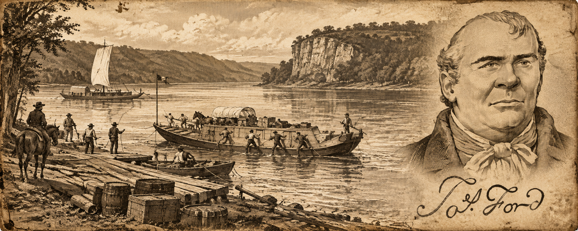
James Ford is usually introduced at the end of the story. By the time he enters most histories, he is already “Big Jim” Ford of the lower Ohio: planter, militia officer, public official, ferry operator and the reputed organizer of one of the most notorious outlaw networks around Cave-in-Rock. That version makes Ford look like a creature produced entirely by the lawless river frontier.
The more interesting story begins farther east. Before Ford’s Ferry became a controlled crossing on the Ohio, the southern Appalachian interior was already being reorganized around exactly the kinds of places that would later make Ford powerful: mountain gaps, river fords, ferries, taverns, toll roads, stock stands, mills and storehouses. Corn and livestock were moving through those corridors, whiskey concentrated agricultural value into something portable, local officeholders frequently doubled as businessmen, and the families who controlled transportation points could become far more influential than their acreage alone would suggest.
James Ford was born in South Carolina rather than Buncombe County, and there is not yet evidence that allows us to claim the Buncombe Fords or Vances were his immediate business partners. The point is more useful than that. The Carolina-to-Tennessee world immediately upstream from Ford’s later Kentucky career already operated according to an economic grammar he would eventually exploit on a much larger and darker scale.


The three images establish the upstream geography. The first maps the old Buncombe Turnpike and its stock stands along the French Broad corridor; the second shows the reconstructed Vance plantation in the Reems Creek Valley; the third is an 1890 photograph of the French Broad below Asheville. Long before railroads took over, river valleys like this were the easiest routes through a mountain landscape that otherwise made commercial travel painfully difficult.
Before the Turnpike, Geography Was the Business
Western North Carolina was never isolated because nobody wanted to trade. It was isolated because moving bulky commodities across the mountains was expensive. Buncombe County’s own historical account describes the early nineteenth-century economy as heavily agricultural and emphasizes that poor roads limited access to outside markets. When the Buncombe Turnpike was completed between 1824 and 1828, it followed the French Broad River through Asheville and connected the Tennessee line with the route toward South Carolina, turning an older path into a seventy-five-mile commercial toll road.
The turnpike mattered because it did not simply make travel faster. It transformed the land beside it into valuable commercial frontage. Stock stands, taverns, blacksmiths, mills, wagon shops, bridges and ferries clustered around the traffic, while farmers discovered that feeding travelers and animals could be more profitable than producing solely for household consumption. Western Carolina University’s history of the road describes between fifty and seventy-five stands along the route, some capable of accommodating enormous droves and many functioning simultaneously as inns, stores, workshops, ferries and community centers.
Alexander’s Stand north of Asheville demonstrates how complete one of these establishments could become. It offered lodging and feed, but also incorporated a blacksmith shop, tannery, wagon factory, grist mill, sawmill, ferry and bridge over the French Broad. The stand was therefore less a roadside inn than a privately operated transportation node where a traveler could eat, repair equipment, cross water, purchase supplies and obtain credit without leaving the property.
That is the world in which the later Ford story begins to make more sense. Control over a crossing was not simply ownership of a boat or bridge. A crossing concentrated customers, information and commodities in one place.
The Mountain Economy Ran on Animals, Corn and Credit
The traffic through Buncombe could be staggering. Contemporary estimates vary, but historical sources commonly place seasonal hog traffic on the turnpike well into six figures. Madison County’s history says droves of several hundred to a thousand animals stopped at stands, while one local account credits David Vance’s establishment at Lapland, present-day Marshall, with feeding around 90,000 hogs during an exceptionally busy month.
Those animals required enormous quantities of feed. Farmers near the route therefore had a ready market for corn even before considering its other uses, and WNC Magazine’s history of the road notes that counties touching the turnpike produced dramatically more corn than neighboring areas. The road did not merely carry agricultural production; it encouraged farmers to change what they produced because the traffic itself generated demand.
Credit was embedded in the system as well. Western Carolina University notes that drovers sometimes paid a stand keeper with an animal or arranged to settle the account after reaching market. The same person might therefore provide lodging, food, feed, repairs and short-term financing, effectively acting as merchant, hotel keeper and informal banker at the same point on the road.
This matters enormously for understanding the later Ohio River world. Ford’s eventual environment of ferry operators, tavern keepers, landholders and local officials was not some exotic criminal invention. The legitimate frontier economy already encouraged one operator to hold several functions simultaneously.
The outlaw opportunity emerged when control of those functions could be turned against the traveler.
Whiskey Made Mountain Agriculture Portable
Corn created another industry that deserves much more attention in the Ford story: distilling. North Carolina’s historical encyclopedia notes that mountain farmers often found hauling raw corn to distant markets economically pointless because the crop occupied too much wagon space for its value. Turning it into whiskey concentrated that agricultural value into a smaller, more durable commodity that could be transported, traded or sold far more efficiently.
Haywood County provides unusually concrete evidence. A North Carolina historic-preservation study reports that the 1810 census recorded twenty-one distilleries in the newly created county producing approximately 4,300 gallons of whiskey. The same report explicitly explains that corn could be profitably distilled for market in a region handicapped by difficult transportation.
Western North Carolina’s distilling economy grew throughout the first half of the century. Research on Appalachian alcohol production found that western North Carolina accounted for a disproportionately large share of the state’s whiskey output, with farmers using whiskey both for cash and barter. One mountain farmer wrote in 1824 that he hoped to make enough whiskey from his corn to pay for necessities and taxes, which captures exactly why distillation mattered in a cash-poor transportation economy.
Whiskey therefore belongs beside cattle, hogs and ferries in this story. It was another answer to the same problem: how do you move value through difficult geography?
The mountain still reduced the bulk of corn.
The drover converted feed into livestock that could walk itself to market.
The ferry converted a difficult river crossing into a commercial service.
The stand converted travelers into customers.
All of those businesses profited from movement.
The Vances Show How Respectable Power Grew Beside the Road
The Vance family is useful here because it shows the legitimate version of this system unusually clearly. David Vance Sr., a Revolutionary War veteran, moved with his family and enslaved workers to the Reems Creek Valley in the 1790s. North Carolina Historic Sites describes him as already wealthy and connected, working as a surveyor, lawyer and teacher while establishing a mountain plantation on newly available land. His son David Vance Jr. inherited the property after his father’s death in 1813.
When the Buncombe Turnpike opened a new commercial opportunity, the younger Vance adapted. In the 1830s David Jr. and Mira Vance moved to present-day Marshall and established a drovers stand directly in the traffic corridor. The operation relied heavily upon enslaved labor: Leah Erwin cooked for travelers, Jim performed blacksmith work, and other enslaved people tended animals, cleaned rooms and grew food.
The important point is not that Vance and James Ford were partners; I have found no evidence showing that they were. The value of the comparison is structural. A prominent local family could combine land, professional standing, enslaved labor and a strategically placed commercial establishment, then profit because outsiders were forced by geography to pass through the corridor.
That formula will look extremely familiar when we reach Ford.


Pack Square in the 1880s preserves Asheville’s older traffic-centered function even after the railroad era had begun. The modern turnpike marker identifies a surviving section of the old drovers’ route, while the Pigeon River bridge in Haywood County represents another crucial mountain crossing. These were not decorative landscape features; roads and river crossings determined where commercial life could develop.
Haywood County Makes the Ford-Tipton Question More Interesting
West of Asheville, the Pigeon River valley presents a second version of the same economy. Haywood County was carved out of Buncombe in 1808–09, and state historical research describes its early settlements clustering in fertile river valleys while residents pushed for roads connecting Waynesville, Beaverdam, Crabtree, Pigeon and Jonathan Creek.
The geography produced place-names that almost write the argument for us. The settlement that became Canton was known at different times as Pigeon River, Pigeon Ford and Ford of Pigeon, precisely because the place where people crossed the river became the place around which settlement accumulated. A state historic-preservation study says farmers later drove livestock and hauled corn and apples along the Western Turnpike, crossing the Pigeon at this settlement before continuing toward Asheville and the Buncombe Turnpike.
There is also a genuine Ford-Tipton presence in this Carolina-Tennessee border world, although it needs to be handled carefully. North Carolina’s land-grant index records John Tipton holding two Buncombe County grants among six grants in western North Carolina and Tennessee between 1784 and 1794. Separately, genealogical records compiled by FamilySearch identify a Benjamin Ford married to Rachel Tipton and place their son John Tipton Ford in Haywood County, where estate and census records survive under his name.
That is enough to establish that Ford and Tipton families occupied this mountain corridor, but it is not enough to make that John Tipton Ford the uncle, cousin or other close relative of James Ford of Ford’s Ferry. That genealogical bridge still needs documentary proof.
The distinction matters because the temptation to collapse every recurring Ford into one family is exactly how good research gets weakened. The mountain Ford-Tipton material is significant whether or not Big Jim belongs biologically to it.
The John Tipton Ford Name Stayed in Haywood
The Ford-Tipton line did not disappear quickly. FamilySearch’s compiled records identify the elder John Tipton Ford’s children in Haywood, including another John Tipton Ford born in the early nineteenth century. A much stronger contemporary item survives for the younger generation: an 1859 newspaper reward notice announcing that Davidson Vick had shot and killed John Tipton Ford in Haywood County and identifying the alleged killer as a former Buncombe County resident. Burton Ford and Joseph Ford offered twenty-five dollars for Vick’s capture.
That notice is useful because it moves the name out of modern genealogy and into a nineteenth-century document. The Ford-Tipton identity was genuinely embedded in the Haywood/Buncombe environment generations after the earliest settlement period.
It also shows how porous the Buncombe-Haywood boundary remained. Haywood had been created from Buncombe, but families, offenders, roads and commerce continued to move across the county line as if the administrative division were secondary to the physical corridor.
The mountains determined the route more strongly than the courthouse did.
Prince Appears on Both Ends of the Story, but the Connection Needs Discipline
The Prince name presents another intriguing trail. Colonial Williamsburg preserves a 1781 document in which John Tipton of Shenandoah County, Virginia, issued official instructions to Captain George Prince concerning the collection of clothing, provisions and wagons for the Revolutionary army. That document demonstrates a real Tipton-Prince association in an earlier Virginia setting, but it does not presently establish that Captain George Prince belonged to the same Prince family later surrounding James Ford.
The Prince connection around James Ford himself is much firmer. Regional historical compilations based on Ford family records and Satan’s Ferryman identify William Prince as Ford’s stepfather after his mother Elizabeth Ford remarried, and Francis Prince later appears in the same lower-Ohio legal environment as Ford’s sons. Hardin County’s historical compilation records Francis Prince providing security with Isaiah Potts for William M. Ford’s ferry license and describes Prince as a likely step- or half-brother of James Ford.
William Prince’s western Kentucky presence is independently documented by the Kentucky Historical Society. Prince surveyed a 200-acre tract at Eddy Grove in 1798, built Shandy Hall and helped establish the settlement that became Princeton, Kentucky. The town itself was initially called Princetown in recognition of the family.
This is important because James Ford did not simply leap from South Carolina into an isolated outlaw colony on the Ohio. His family world was already moving through the Tennessee-Kentucky frontier where land acquisition, roads, taverns and public authority were becoming intertwined.
James Ford Emerges Downstream
Ford was born in 1775 in South Carolina’s old Ninety-Six District, in the region of present-day Spartanburg. By the late 1790s he had reached the lower Ohio country, where the river itself became the commercial road that the mountain turnpikes had only begun to imitate.
The scale had changed dramatically. Instead of driving livestock through a mountain gap, settlers and merchants could load flatboats with agricultural goods and float them downstream toward major markets. Ohio-Mississippi traffic moved flour, pork, whiskey, livestock, timber and manufactured goods through a long chain of landings, ferries and river settlements.
The economic principle remained familiar. Every difficult crossing created an opportunity for somebody who controlled the landing.
James Ford eventually became that person.
His public career included militia commands and local offices on both sides of the Ohio. Regional records identify him as a Kentucky militia captain beginning in 1799, later an Illinois Territorial militia officer, justice of the peace and ultimately sheriff of Livingston County. Those positions gave Ford social authority while he simultaneously accumulated land and transportation interests.
The “river pirate” therefore needs to be understood as a civic operator before he is understood as an outlaw. Ford’s danger came precisely from the overlap between the two roles.
Ford’s Ferry Was Not Just a Boat
Ford secured authority in 1823 to operate a ferry across the Ohio near the mouth of Crooked Creek, and his family later expanded ferry interests in the same region. His son William obtained the license for the former Flinn’s or Prince’s Ferry farther upriver, while Ford-controlled roads connected the crossings with interior routes.
A surviving Livingston County road record from 1829 is particularly revealing. Ford petitioned the county court over the route running from his ferry, showing him participating directly in the official process by which public roads were surveyed and established. The ferry operator was therefore not merely waiting for traffic to arrive; he was involved in shaping how that traffic reached the river.
That is where the Buncombe comparison becomes useful. Alexander’s Stand had lodging, shops, mills, a bridge and a ferry because controlling several traveler needs in the same location made commercial sense. Ford’s Ohio system represented the same logic extended across a much rougher frontier environment.
The critical difference was what later accounts say Ford did with the advantage.
The Road and Ferry Could Become a Trap
Regional histories and the standard twentieth-century study Satan’s Ferryman associate Ford with a network of robbers and violent operators who preyed upon travelers along the lower Ohio. The Crittenden County Historical Museum still describes Ford’s gang as attacking migrants and families moving westward, while Hardin County historical research links Ford’s circle with Isaiah Potts, the Potts Inn environment, counterfeiting networks and other criminal figures around the Illinois salines.
Not every lurid Cave-in-Rock tale should be accepted automatically. An older claim that Ford himself was the “James Wilson” running an establishment inside Cave-in-Rock in 1799 is now generally rejected because records show that an actual James Wilson was present separately.
The better documented picture is more interesting anyway. Ford did not need to sit inside a cave waiting for victims. His position around ferries, roads, land, law enforcement and local business gave him access to information about who was traveling, what they possessed and where they were headed.
The crossing itself provided intelligence.
That is exactly what an Appalachian stock stand had provided in a legitimate setting decades earlier: travelers arrived, stated their destination, purchased services, left animals or credit arrangements behind and then moved onward.
The difference between commerce and predation could become frighteningly small when the same operator controlled both the road and the threat along it.


Karl Bodmer’s 1832 view of Cave-in-Rock is especially valuable because it shows the Ohio during Ford’s lifetime rather than the romanticized frontier of much later illustrations. The two ferry photographs are later, but they preserve the physical logic of the crossing: wide water funnels people and goods toward a small landing where the operator controls passage.
Salt Made Ford More Than a Ferryman
Ford’s economic reach also extended into the Illinois salines. Hardin County historical research identifies Andrew Frazer as Ford’s agent at the saltworks of James Ford & Co. in 1828, while other accounts connect Ford through his second marriage with the Frazier salt interests.
Salt was one of the indispensable commodities of the early American interior because food preservation depended heavily upon it. A saltworks therefore required labor, fuel, transportation and distribution, putting Ford into another business where control of physical movement mattered as much as production itself.
This also introduces the darkest part of the frontier labor system. Ford owned enslaved people, and accounts of the Illinois salines describe enslaved labor being leased into salt production despite Illinois’s nominal free-state status. Ford has additionally been linked by historians to John Hart Crenshaw and the illegal kidnapping of free Black people into slavery, although individual allegations vary in evidentiary strength and should be separated from the more firmly documented salt and slaveholding records.
The road, ferry and saltworks therefore belong together. They were pieces of an economy in which landowners controlled access to resources, transportation and labor.
The Mountain Road Helps Explain the River Pirate
None of this proves that James Ford learned his methods directly from David Vance’s stand, a Haywood distiller or a particular Buncombe tavern. That would be a claim beyond the evidence.
What the Carolina history gives us is the missing economic environment.
Western North Carolina demonstrates what happened when transportation was difficult and movement concentrated around a few usable corridors. Farmers distilled corn because liquid value traveled better than grain. Drovers moved cattle and hogs because the animals carried themselves. Stock stands accumulated lodging, blacksmithing, food, credit and ferries at the same location. Surveyors and lawyers acquired land along routes that would become increasingly valuable once traffic intensified. Families such as the Vances could turn public standing and strategic geography into commercial power.
Haywood adds another layer. The county’s early distilleries, Pigeon River crossings and Ford-Tipton presence show that the road west from Buncombe was not empty territory. It was already developing the same mixture of family networks, alcohol production, livestock, land acquisition and crossing points that characterized the broader Appalachian frontier.
Then the Prince family carries the story toward Tennessee and western Kentucky, where James Ford eventually appears inside a far larger river system.
By the time Ford reached the Ohio, he did not need to invent the commercial logic of the frontier.
He only had to weaponize it.
The Ferry Was the Downstream Version of the Stock Stand
This is probably the cleanest way to understand Ford’s Ferry. A stock stand on the Buncombe Turnpike and a ferry landing on the Ohio perform many of the same economic functions at different scales.
Both occupy a place where traffic cannot move freely without interacting with the operator. Both produce information about strangers. Both create opportunities for lodging, trade, credit and repairs. Both can become centers of local authority because travelers and neighbors repeatedly need the services concentrated there.
The ferry adds something the road stand does not possess: physical control over the instant of crossing.
A traveler cannot simply walk around a wide river carrying a wagonload of property.
That makes the ferry operator disproportionately powerful.
Ford understood that advantage extremely well.
James Ford Looks Less Like a Random Outlaw Once the Road Is Restored
The conventional river-pirate story isolates James Ford because it begins at Cave-in-Rock and asks how such a bizarre criminal could have existed. The question changes completely when the history begins upstream.
There was nothing bizarre about a prominent frontier businessman holding several roles simultaneously. David Vance could be part of a prominent landholding family while operating a giant drover stand. Alexander’s Stand could be hotel, mill, tannery, repair shop, ferry and credit point at once. Western farmers could turn corn into whiskey because it traveled better, while local officials could simultaneously be surveyors, lawyers, militia officers and land speculators.
James Ford belongs to that broader frontier pattern before his alleged crimes distinguish him from it.
His ferry was infrastructure.
His roads were infrastructure.
His saltworks were infrastructure.
His public offices gave him authority inside the community that depended upon that infrastructure.
The criminal allegation is that he used those legitimate systems to identify, isolate and prey upon the same people who depended on him for passage.
That is far more disturbing than the image of a wild outlaw hiding in a cave.
The Ford-Tipton Trail Is the Research Problem Still Sitting Upstream
There is one piece we should not force closed yet. The Benjamin Ford–Rachel Tipton–John Tipton Ford genealogy places a Ford-Tipton family in the Carolina mountain corridor, while contemporary records establish later John Tipton Fords in Haywood County. Separately, James Ford’s documented western network contains strong Prince family connections, and John Tipton himself had documented dealings with a Captain George Prince decades earlier in Virginia.
Those facts create a research target rather than a conclusion.
At present, they do not prove that the Buncombe/Haywood Ford-Tipton family was Big Jim Ford’s family, nor do they prove that Captain George Prince was connected to William or Francis Prince. The next useful work would be comparing deeds, probate files, Revolutionary claims and migrations rather than relying upon repeated online family trees.
But even without that missing genealogical bridge, the geography already tells us something important.
The Ford name, the Tipton name and later Ford-Tipton descendants occupy the same western Carolina-Tennessee world through which livestock, whiskey, land claims and political authority were moving toward the interior.
James Ford later appears downstream doing business in the same basic language.
Before the River Pirate Came the Road
James Ford’s later reputation makes Ford’s Ferry seem like the beginning of the story, but the ferry was really a mature form of something the Appalachian interior had been building for decades.
First came the path through the mountains.
Then the ford.
Then the tavern.
Then the stock stand.
Then the toll road.
Then the ferry.
Each development narrowed movement into places where an operator could charge, observe, record and sometimes control the traveler.
Whiskey belongs in that history because it turned difficult-to-move grain into portable value. Livestock belongs in it because animals could carry mountain agriculture to distant markets under their own power. Vance belongs in it because the Vance operation demonstrates how a prominent family could profit enormously by positioning itself beside the flow. The Ford-Tipton material belongs in it because it places another Ford world directly in the Pigeon River and Haywood corridor without yet forcing that branch onto Big Jim.
Finally, James Ford belongs at the downstream end because Ford’s Ferry represents what happens when the commercial power of a frontier crossing becomes concentrated in the hands of someone who is simultaneously businessman, landowner, officer of the law and—according to the historical accounts that gave him the name “Satan’s Ferryman”—predator.
Cave-in-Rock may be the memorable image, but the cave did not create that system.
The road did.