Lost Civilizations
February 21, 2026
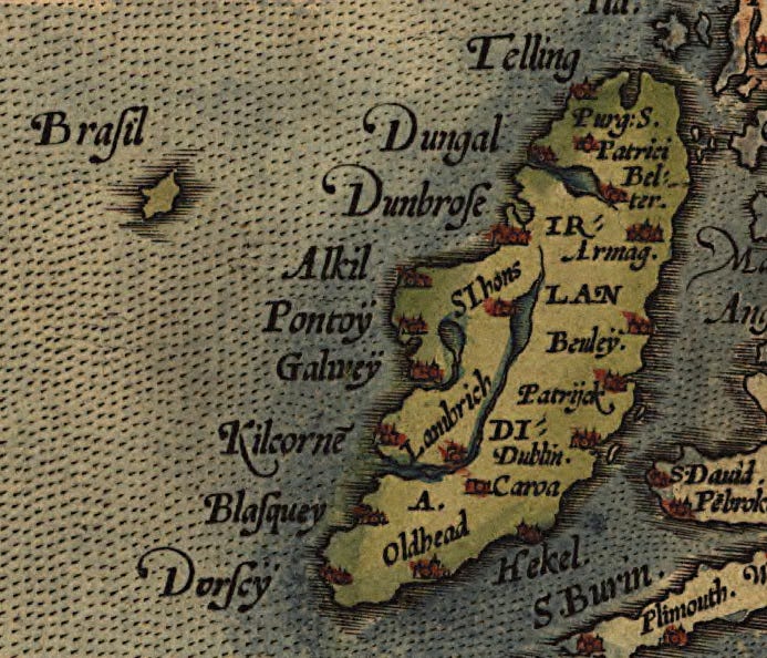
Hy‑Brasil, the Templars, and the Atlantic Supply Chain
unnameablemedia
February 21, 2026
The Oracle Machine: Interpreters, Watchers, and the System That Shapes Reality
unnameablemedia
February 21, 2026
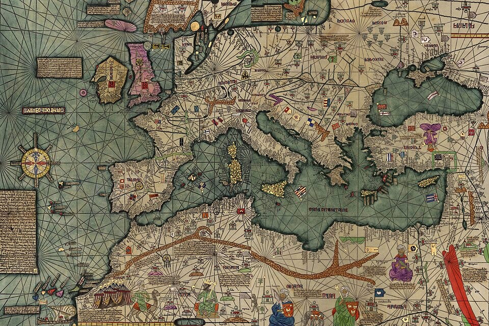
Gold, Purple, and Wind: Reading the Catalan Atlas
unnameablemedia
February 21, 2026
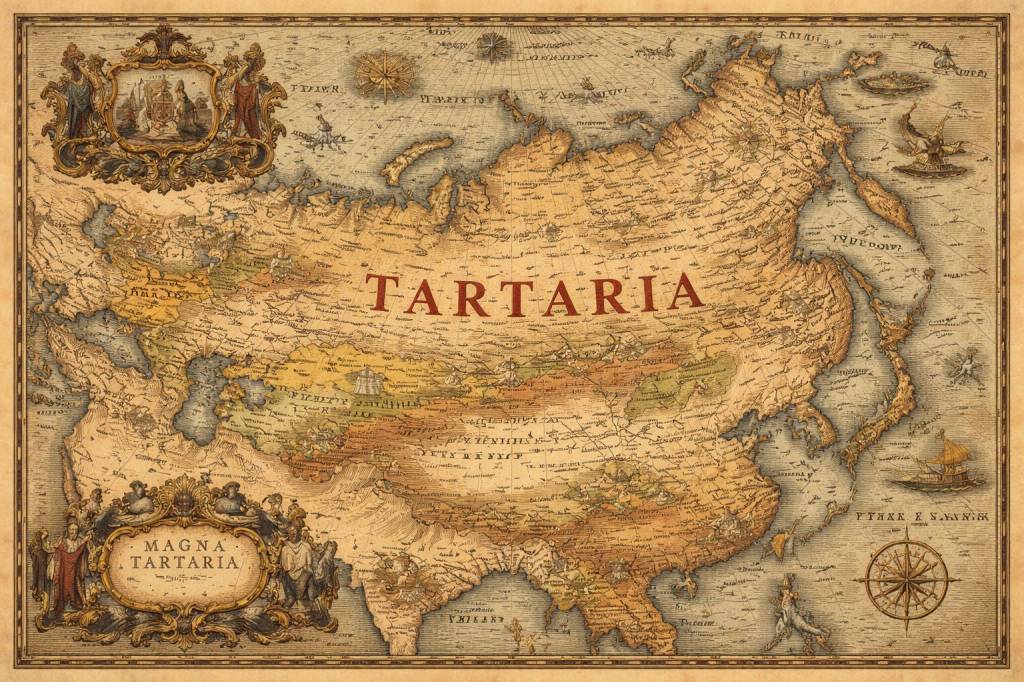
Reconsidering Tartaria: Frontier Confederations, Erased Institutions, and the Myth of the Lost Empire
unnameablemedia
January 2, 2021
A Note From History
unnameablemedia
Privacy & Cookies: This site uses cookies. By continuing to use this website, you agree to their use.
To find out more, including how to control cookies, see here:
Cookie Policy
Subscribe
Subscribed
Unnameable Media
Sign me up
Already have a WordPress.com account?
Log in now.
Unnameable Media
Subscribe
Subscribed
Sign up
Log in
Report this content
View site in Reader
Manage subscriptions
Collapse this bar